Recent Photos of El Paso GFA, TX
Looking North

Looking East (2014)
Looking South

Looking South (2014)

Looking West (2014)
-----------------------------------------------------------------------------------------------------------------------------------------------------------------------
The following five photos of the former El Paso Gap-Filler Annex were made by Tom Page on Friday afternoon, 19 April 2019. Many thanks go to the owners of the Mile High Hacienda & Ranch for allowing access.

This photo shows the outside of the radar-equipment end of the building (front right) and, to its left, a triangular deck (with a hot tub in its center) that covers the three radar-tower foundations. Some kind of flue exits the building where the waveguide once did. The original cinderblock walls of the building have been covered with stucco, and windows have been added. [Looking south]
.

This photo shows one of the three radar-tower foundations under the deck. This is the one closest to the building, on the right as one looks away from the building.
.

This photo shows another radar-tower foundation under the deck, the one farthest from the building. All three foundations still have their mounting plate and bolts, plus about a foot of tower leg (which had simply been cut off).
.

This photo shows the interior of the former radar-equipment section of the orginal building, looking east toward the end where the waveguide exited the building. The four air vents in the roof / ceiling have been replaced with sky lights. The diesel-generator section of the building (not photographed) is now a kitchen, with a doorway leading through what was once the firewall. Much more has been added on to this old radar facility, too.
.

This final photo shows the view from the former radar site looking west. The road below is US Route 180 & 62 which leads back to El Paso.
.
-----------------------------------------------------------------------------------------------------------------------------------------------------------------------
The former El Paso Gap-Filler Annex is now the Mile High Hacienda & Ranch. The following four photos come from the their website, http://www.milehighhacienda.com/gallery/, and are displayed here with permission for historical / non-commercial purposes.


March, 2002 photos by Tom Page
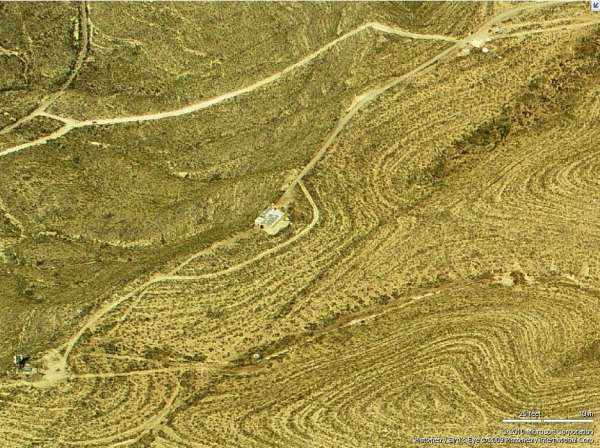
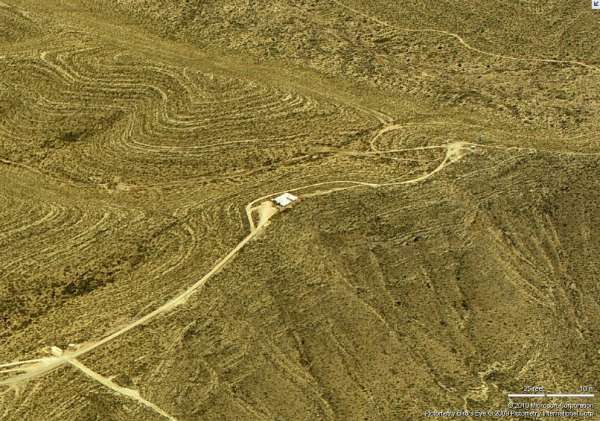
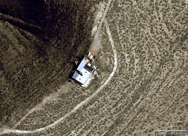
The location of the El Paso gap-filler radar annex -- located about 20 miles east of the city of El Paso at the west edge of the Hueco Mountains -- was first identified by Scott Murdock using a U.S. Army real-estate map. The "TerraServer" aerial imagery does not seem to show a typical L-shaped building. As it turns out, neither does any ground-level view.
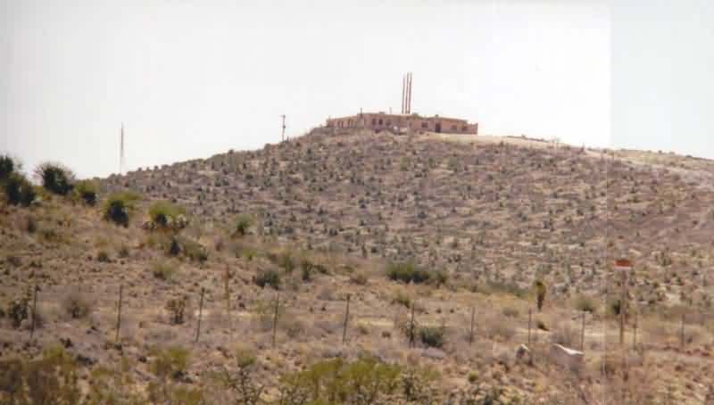
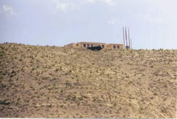
Halfway up the access road (which goes east and then south from Loma Linda Blvd., which runs south from US Rte 62 / 180), there was a locked gate with two "No Trespassing" signs that strongly discouraged any up-close looks of the facility. Photos had to be taken from a distance. The first two photos were taken from near the access-road gate, north and east of the site; the first photo used a 55-mm "normal" lens, and the second (actually a composite of two photos) used a 300-mm telephoto lens. The third photo was made from US Rte 62 / 180 below the site, from a point to the northeast.
It is clear, given that this indeed is the old GFA site, that the original structure has been greatly altered and enlarged. It does appear that the center section (as viewed in photo #2) was probably the original GFA building; its appearance is somewhat consistent with that of other GFA buildings. However, this conclusion is far from definite. Also reported by Scott, the site went to the Army after its gap-filler days, and was used for instrumentation of the White Sands Missile Range -- that could explain some of the modifications. [A local resident did say he had heard that the facility had once been an Air Force radar site, or something to that effect.]
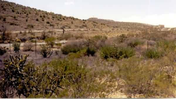
A view of the former El Paso GFA facility, now greatly altered, from north and east of the site. [looking southwest]
Another view of the former El Paso GFA facility from north and east of the site, this time using a 300-mm telephoto lens. It is speculated that the center section was probably the original GFA building, but this is not certain. [looking southwest]
A view of the former El Paso GFA facility from US Rte 62 / 180 below the site, from a point to the northeast, also using a 300-mm telephoto lens. [looking southeast]