North Truro AFS, MA Recent Photos
--------------------------------------------------------------------------------------------------------------------------------------------------------------------
.
.
.
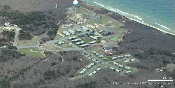
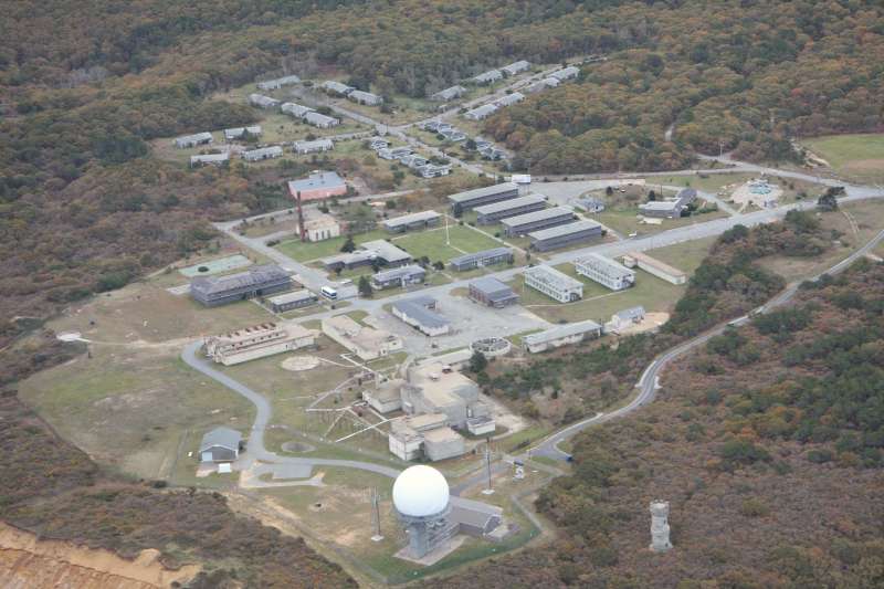
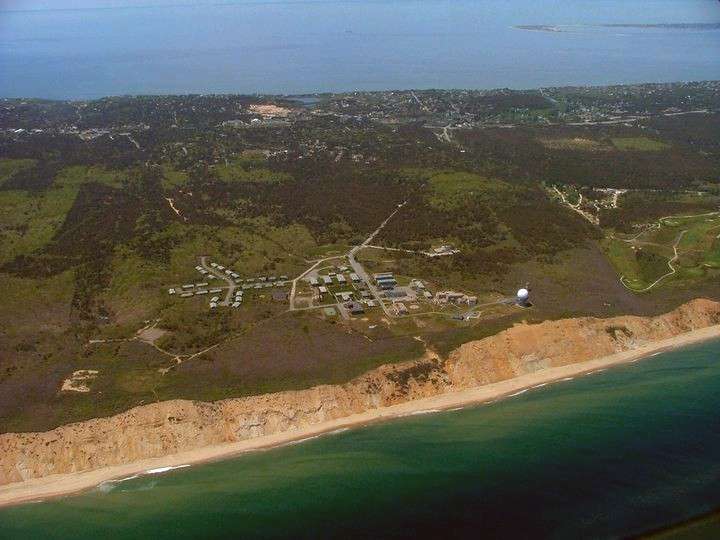
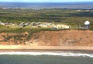
High-level view of the former AF Station (looking south)
.
.
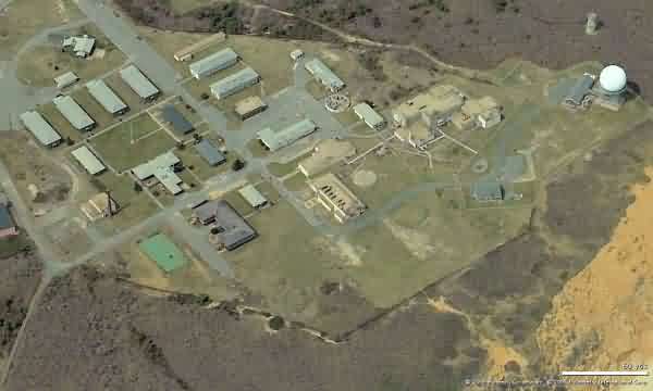
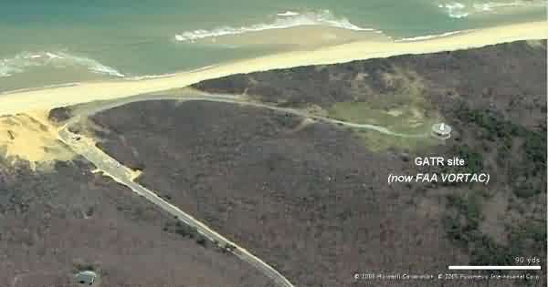
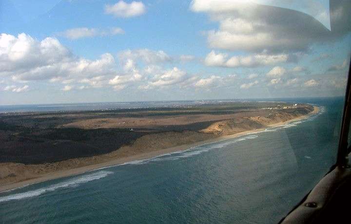
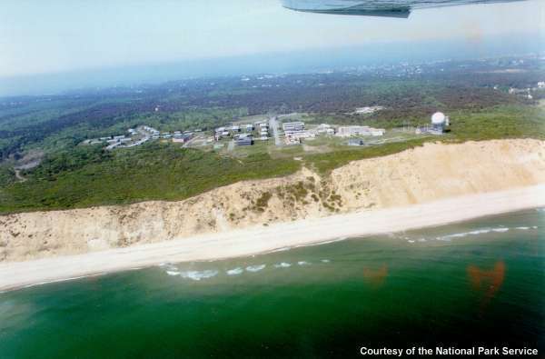
Close-up view of the former AF Station in the foreground and the former GATR site (now FAA VORTAC facility) in the far distance (looking south)
.
--------------------------------------------------------------------------------------------------------------------------------------------------------------------
Fly-over video: https://vimeo.com/151380540
--------------------------------------------------------------------------------------------------------------------------------------------------------------------
Drone video, https://www.youtube.com/watch?v=HR2UQoNbu9s
--------------------------------------------------------------------------------------------------------------------------------------------------------------------
Looking North
Looking South
Looking West
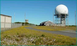
GATR Looking North
GATR Looking East
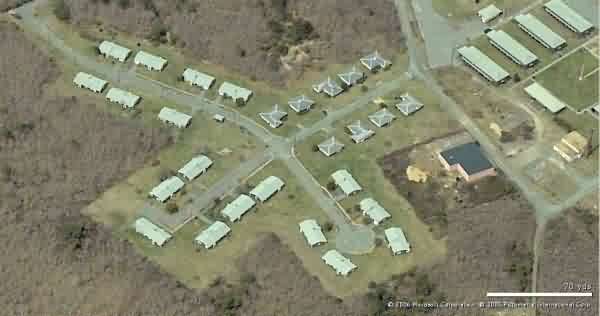
Housing Looking West
-----------------------------------------------------------------------------------------------------------------------------------------------------------------------

Photo source: http://www.courant.com/travel/hc-cape-cod-nature-trails-0726-20150723-story.html
Displayed here for historic / non-commercial purposes only
Jan 2011 photo from the Cape Cod Times.
2009 photo source: http://skyout.blogspot.com/
Also, there is a linked video showing an overflight of the area including the radar site, found also on YouTube at http://www.youtube.com/user/furrod1#p/a/u/0/aZ_B3Do7660.

2008 south-looking view contributed by Mark Foster
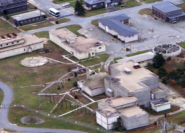
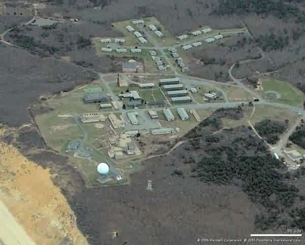
Cropped from above, showing the two Operations buildings and the radar areas close up.
Historian note: To date, this is the best photo I`ve seen that shows in detail both the original AC&W Operations building (top center) and the later BUIC-II / BUIC-III / SAGE Operations building (bottom center).
Most of the original radar-tower foundations are seen, too. The foundation on the far right (west) was for the AN/FPS-6B (later AN/FPS-90) height-finder radar. The foundation immediately left (east) of the AC&W Operations building (and immediately north of the Power Plant) was for the early AN/CPS-6b search radar. The faint foundation at the center left was for the AN/FPS-8 (later AN/GPS-3) search radar. The foundation at the bottom left was for the other AN/FPS-6. The AN/FPS-7 (-107) search radar was out of the photo to the left, and the AN/FPS-26A height-finder radar was out of the photo to the bottom (north). The modern ARSR-4 radar tower is also out of the picture to the north.
The following 2007 photos contributed by Ed Ririe

ca 2004 photos
Main site
The former GATR site (now a VORTAC facility) is seen near the center; the main radar station is off to the right where the shoreline curves.
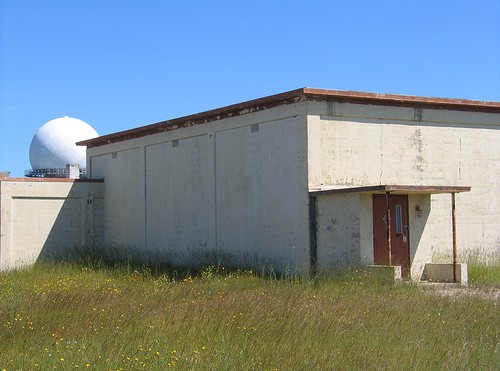
Photo source: http://www.flickr.com/photos/49081287@N00/609412565/
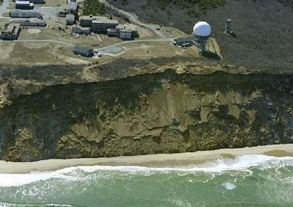
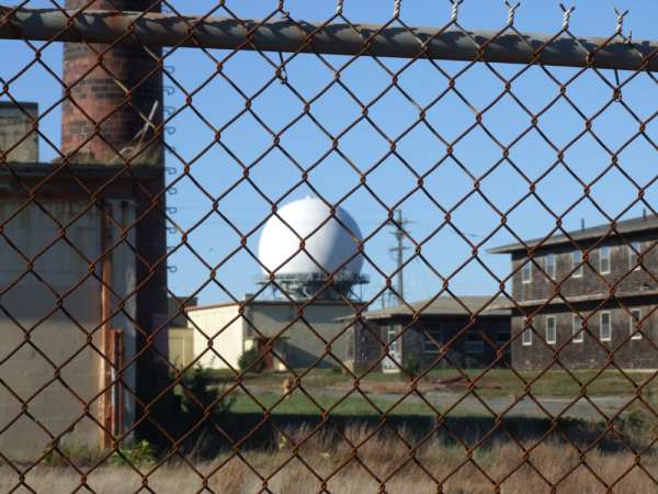
This recent photo shows the original AC&W Radar Operations building (not the BUIC blockhouse) in the foreground, with the modern ARSR-4 radar dome in the distance.
Source: http://hcitruro.org/theidea.php
Reunion Productions
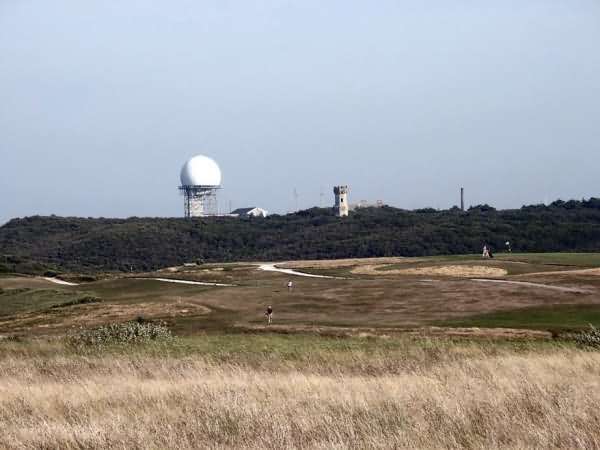
A view of the radar station from Highlands Golf Course
Source: http://www.chezjag.net/ptown/cclightgolf.jpg
source: http://www.capecodphotoalbum.com/truro.html
The photographer writes, "From the lighthouse, the U.S. Air Force Station looks like a giant golf ball."
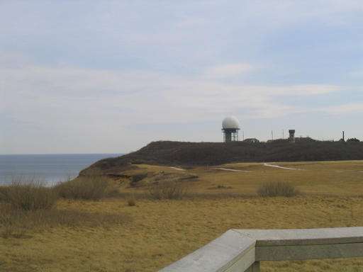
Photo source: http://www.smoe.org/meth/gallery/script.cgi?page=27&options=D&options=T&options=U
Two views from Highlands Golf Course
From National Park Service, Jeff Selleck
Now the CACO Research Learning Center
From the web site http://www.volpe.dot.gov/infosrc/highlts/03/julyaug/d_human.html
From the web site http://lynx.dac.neu.edu/t/tberman/news.html
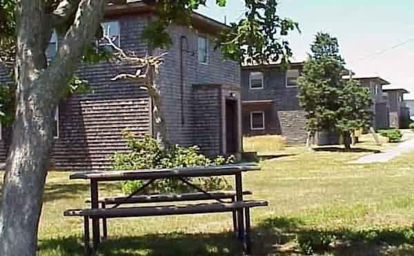
Picnic Grove near enlisted barracks
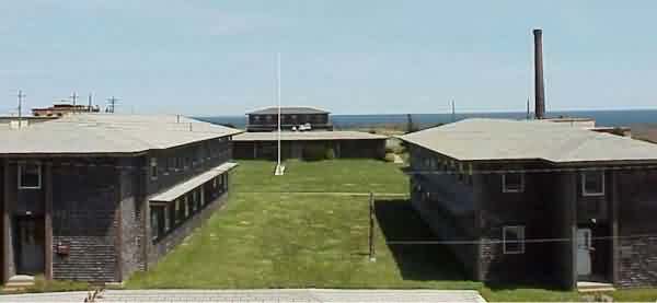
Quadrangle, looking east
TT-2 Orderly Room (left) & BOQ (right)
April 2001 photos and notes contributed by Tom Page from the "New" Tour, 2001
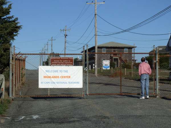
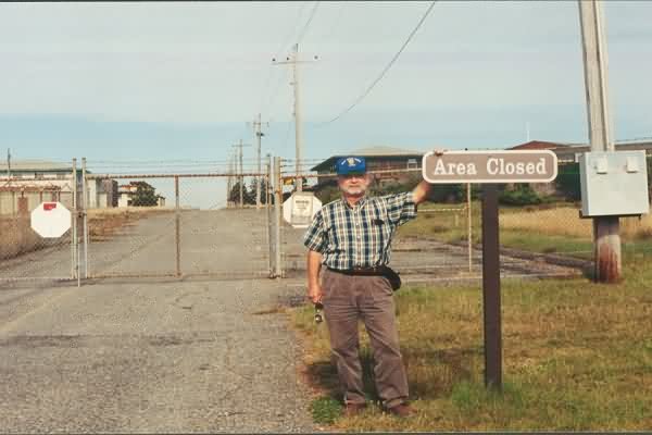
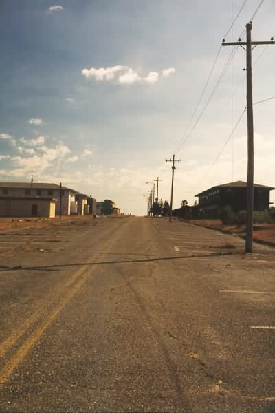
The former North Truro AFS, now JSS radar site, is located east of US Rte 6 on outer Cape Cod, about two miles south of the Highlands Lighthouse, at the eastern end of ''Dewline Road'' (obviously a misnomer). The former cantonment and technical areas are fenced-off, but the family-housing area is accessible on foot.
The former Texas Tower No. 2 (TT-2) troposcatter communications site, just south of the housing area, is also still accessible on foot. All that remain of the tropo facility are the building foundation (a concrete pad with a few floor tiles) and three-each concrete footings for the three tropo dish antennas.
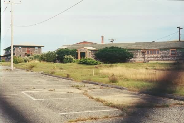
At the main site, the fence around the former cantonment and technical areas has a gate on the ocean-facing side, which has been ajar ever since before I was there in 1979. It was still open, so were were able to enter the area and take photos. All of the original USAF radar towers (including the AN/FPS-107 whose photo is used in the ''Radomes, Inc.'' logo) are gone now. The only radar tower now is the ARSR-4. The buildings appeared in pretty good shape, better than the housing units which had a number of broken windows. A few buildings had been torn down, including the station chapel where my wife and I got married in 1980. The softball field outside the fenced area is still used by local leagues. There is a plan afoot to convert the station into a Art Center for the town of Truro.
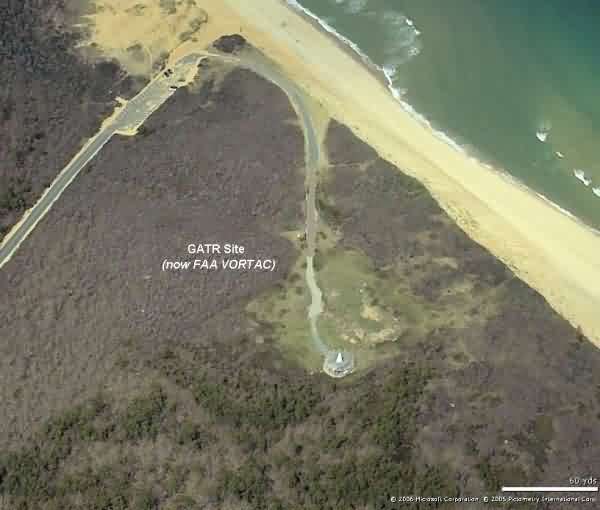
The former GATR site is located at the eastern end of Longnook Road, about two miles south of the main site, on the hill top immediately south of the Longnook Beach parking area. The access road has a locked bar (gate) across it. The GATR building itself has been demolished, and all of the radio poles have been removed. The site is now home to an FAA NAVAID station; it appears to be a VORTAC or similar facility.
The former North Truro AFS, now JSS site, is located east of US Rte 6 on outer Cape Cod, about two miles south of the Highlands Lighthouse, at the eastern end of Dewline Road (obviously a misnomer). The GATR site is located at the eastern end of Longnook Road, about two miles south of the main site, on the hill top south of the beach parking area.
View of the present-day ARSR-4 radar tower, as seen from the site entrance (looking north-northeast).
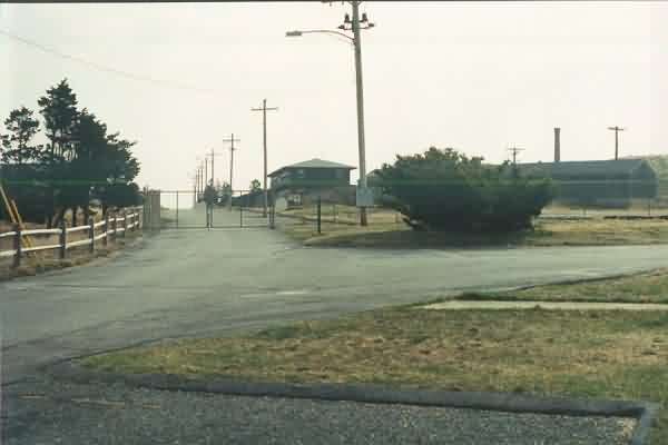
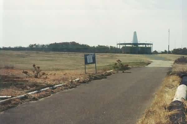
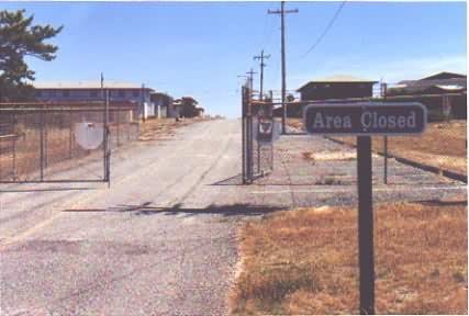
Entrance into the former cantonment area. Chapel used to sit on the corner. [Looking east.]
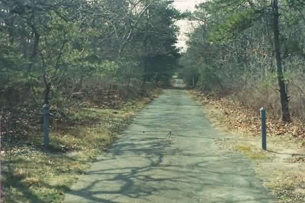
Road leading from the main site to the former TT-2 troposcatter communications site on the south corner of the station. [Looking south-southeast.]
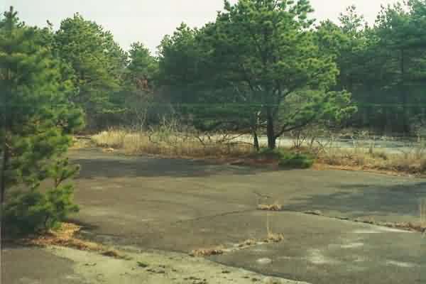
Former TT-2 troposcatter communications site (looking east-northeast).

Concrete foundation (pad) for the former TT-2 troposcatter communications site (looking south). Some floor tiles are still present.
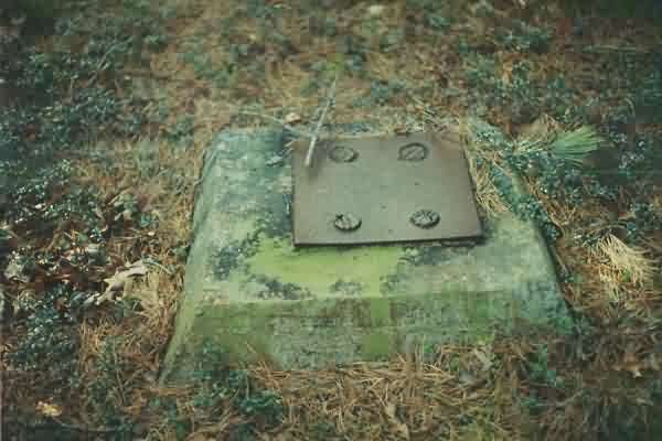
One concrete footing for the northern-most troposcatter antenna tower. Each tower had 3 legs, and this site had 3 towers total, arranged in a straight line running N-S, with each antenna dish pointing nearly due east (towards Texas Tower No. 2). Orginally, the three tropo antennas were dual back-to-back antennas, for a total of six, with the western ones pointing to Stewart AFB (HQ Boston Air Defense Sector {BoADS}) near Newburgh, NY. [See vintage Photos.]
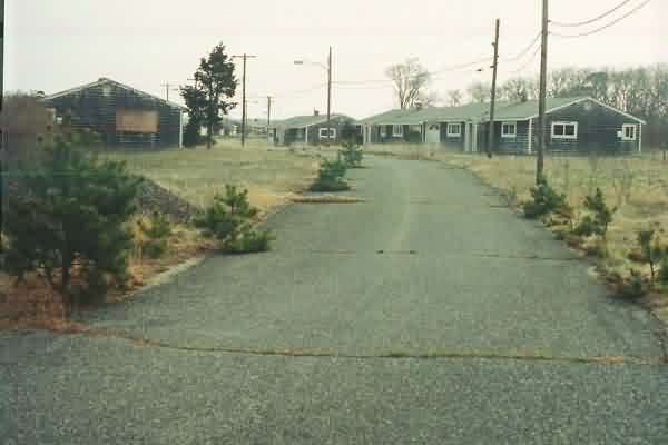
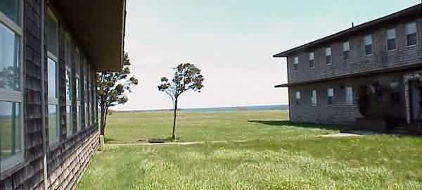
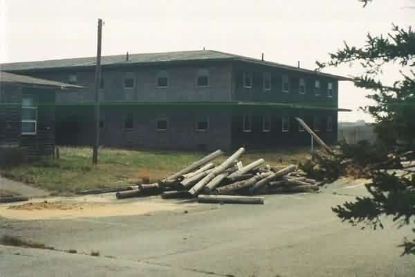
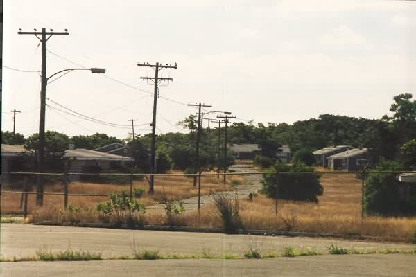
North Truro AFS family-housing area (looking east).
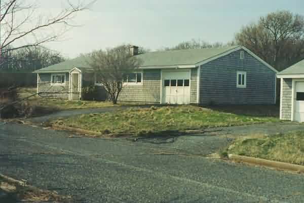
North Truro AFS family-housing area (looking south). The pictured house is #214, my residence from Feb. to Sept. 1981.
Another view of my former residence (looking north). The ARSR-4 is seen in the distance.

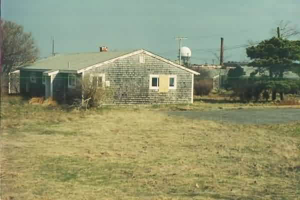
North Truro AFS family-housing area (looking west-northwest). Shown are some of the older units from when the site was first built.
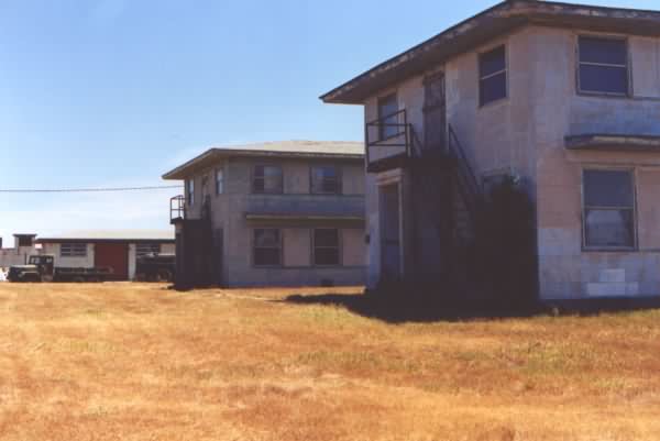
BOQ (looking north).
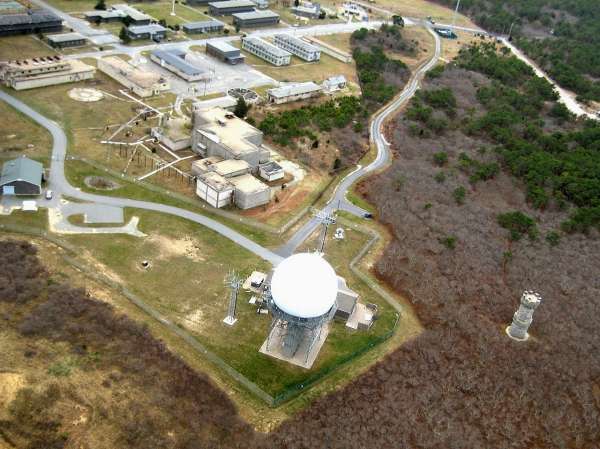
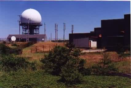
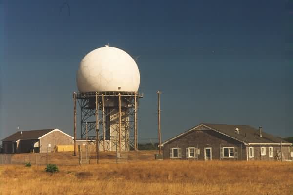
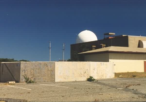
ARSR-4 radar tower (looking north). In the center of this photo is where the AN/FPS-107 search-radar tower used to stand; that was the tower used in the ''Radomes'' logo. Beyond that, where the nearest FAA 'house' now stands, is about where the AN/FPS-26 height-finder radar tower used to stand.
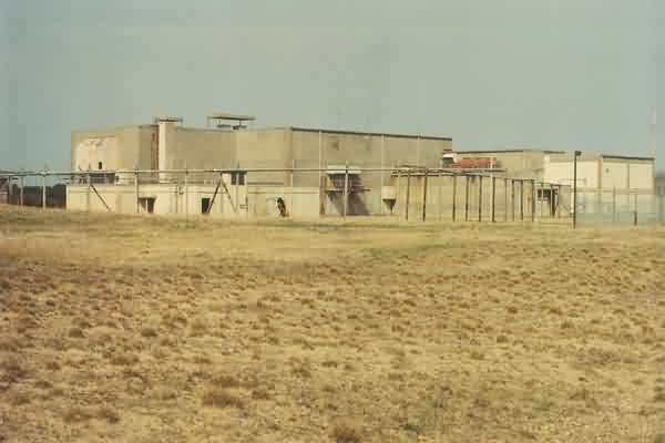
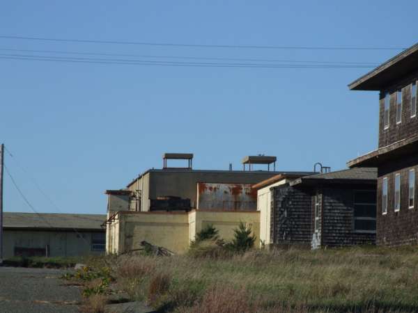
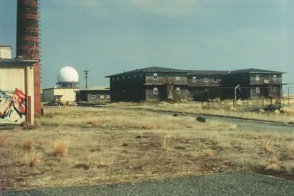
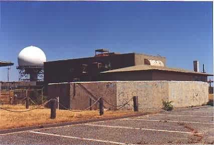
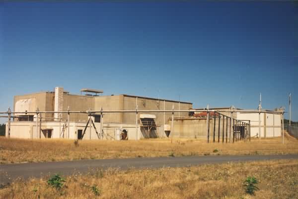
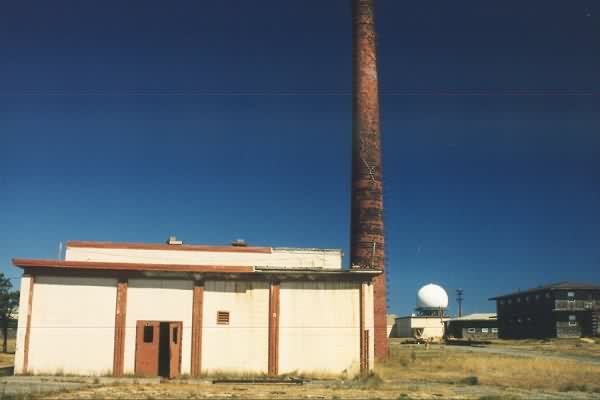
LRR Operations and BUIC blockhouse (looking west-northwest).
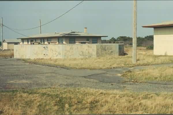
Old AN/CPS-6b search-radar tower foundation, located 'behind' (north of) the diesel power plant. The AN/FPS-107 search-radar tower used to stand in the background on the right. [Looking northeast.]
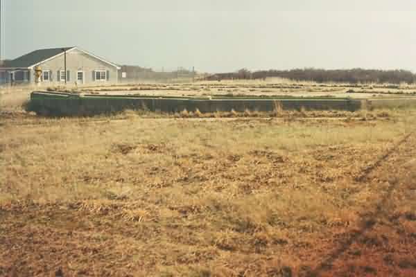
Foundation of the AN/FPS-90 (most recently AN/FPS-116) height-finder radar tower. Behind the radar tower was the Civil Engineering building, with station Supply to the right. [Looking west.]
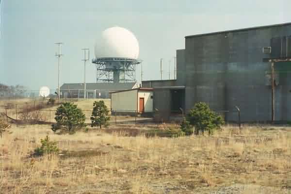
Another view of the present-day ARSR-4 radar tower, from 'behind' the BUIC blockhouse (looking north-northeast).
Another view of the BOQ. Before getting married, I resided in the 1st-floor corner room seen in this photo. The small building to the left reportedly was once the orderly room for TT-2. [Looking south-southeast.]
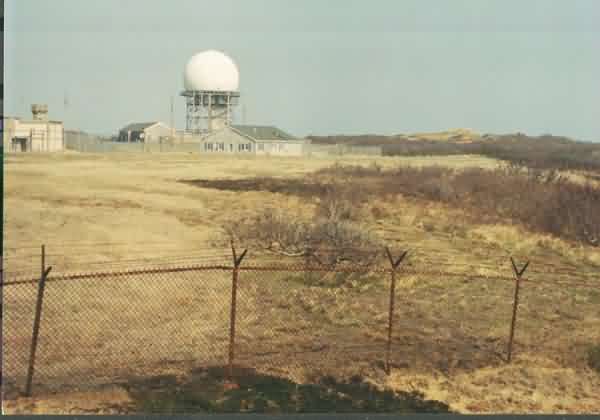
The old GATR site is now home to an FAA NAVAID station (appears to be VORTAC or similar). The GATR building stood in the depression to the left (northeast) of the NAVAID structure. [Looking south.]
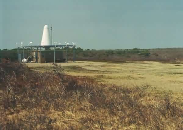
Another view of the former GATR site and present-day FAA NAVAID station (looking west).
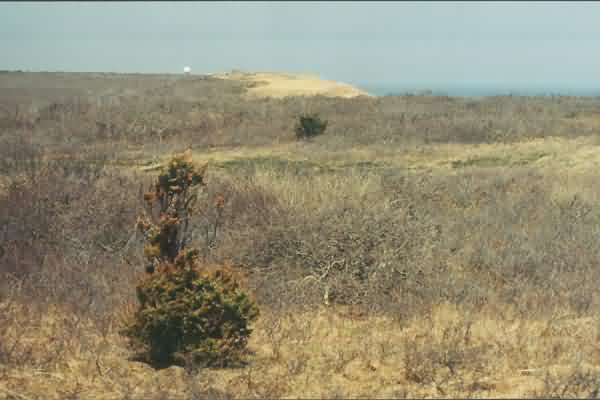
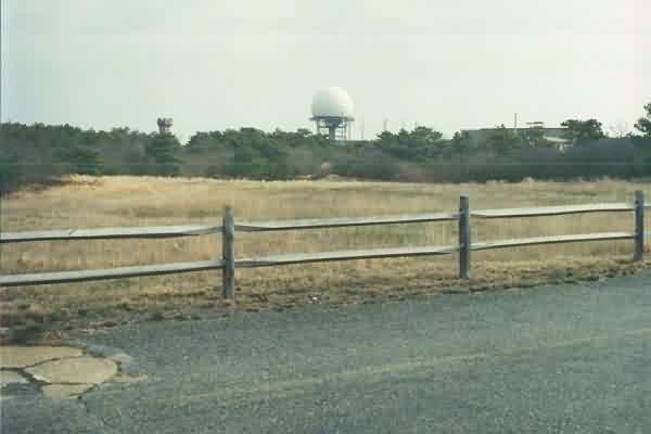
View of the ARSR-4 radome as seen from the former GATR site (about a mile in distance). [Looking north.]
Late Summer, 2000
The following three photos contributed by Charles E. "Chuck" Rowland
Main Gate
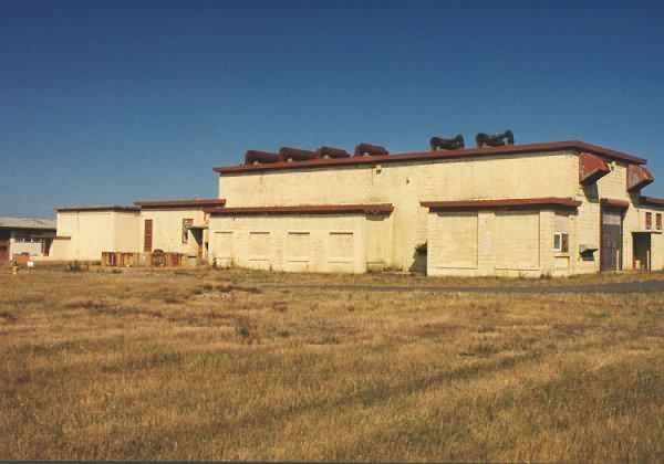
Building to the right of the Main Gate was the Consolidated Club. To its left was the Command/Admin/Personnel/etc. building (originally a barracks).

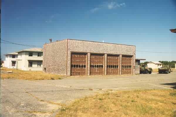
Buildings to the left of the main gate. The first building was the 2-lane bowling alley. Behind it were two former Sr NCO barracks. Behind the second one was the Motor Pool.
North Truro AFS, MA Recent Photos - 1999
The following five photos from 1999, contributed by Don Bender
ARSR-4 in background. It was fairly NOISY or so I thought. Even at that distance ... Interesting. FPS-90 foundation in foreground.

The following 1999 photos contributed by Bruce Herrick, with comments by Tom Page
ARSR-4 Tower
SAGE LRR Ops/BUIC Operations Blockhouse. Far back, right was TELCO. Looking northeast.
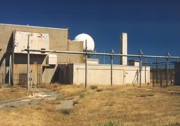
another view of the Ops/BUIC Blockhouse. (my office was just inside the 1-story light tan wing jutting out)
- foundation for old AN/FPS-90 (FPS-116) in center foreground
- supply building to right of FPS-90
- blockhouse (BUIC/LRR Ops) to NE
- ARSR-4 in background
- "Jenny Lind" tower to left, backgroung (story in a separate document at another time)
Power plant
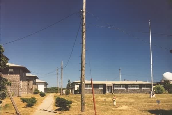
Looking north from station center square. Airman, Jr. NCO barracks on left. Last building on left was Hq/Admin. Rec hall/library in center.
Heating plant, foreground, center. BOQ, far right, 2-story bldg. Former Texas Tower #2 orderly room north of BOQ, then former manual ops bldg (then movie theater). Finally, new ARSR-4 in background.

Looking southwest. Rec. center/library in center. Hq/Admin bldg on far right.
Looking east, towards the ocean.
Motor pool, Sr. NCO barracks, which were no longer used even when I was there.
House at far end was the Commander`s house. Last house to the right (#214) was the one I lived in, after getting married.

