Recent Photos of West Mesa AFS, NM (M-94 / Z-94)
Microsoft "Bird`s Eye Images
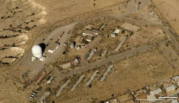
Looking North
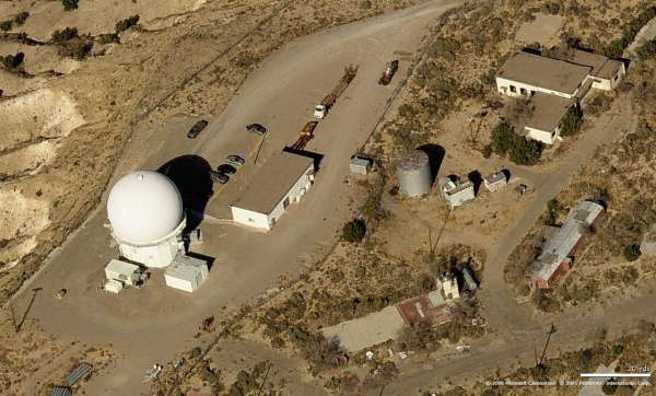
Looking North
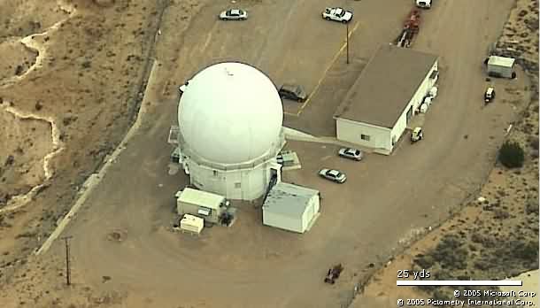
Looking North
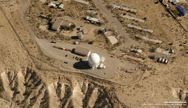
Looking East
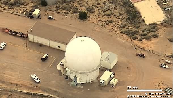
Looking East
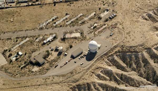
Looking South
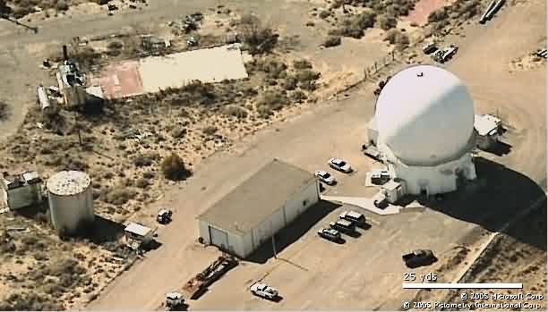
Looking South
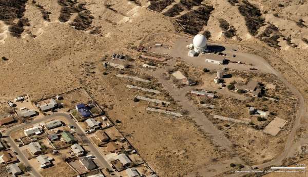
Looking West
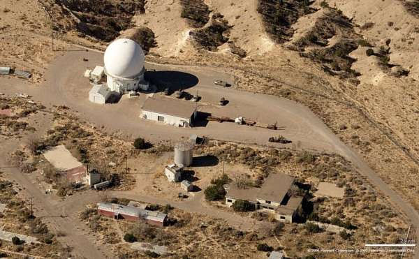
Looking West
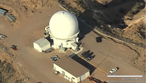
Looking West
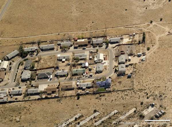
Housing - looking South
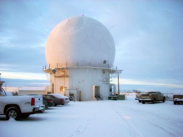
source: http://www.dsei.com/site/index.php/services/industries/federal-government
© Copyright - All Rights Reserved - Displayed here for historical / non-commercial purposes only.
The view appears to be looking west.
October, 2004 photos & notes contributed by Tim Tyler
Coords: 35-04.12N/106-52.5W
Arrival time: 1704MDT/2305Zulu
Mileage: 77214 Trip Odometer: 290.7
Status: Former Technical/Ops area was secured for FAA RADAR & ground/air radio site, though former AFS housing is open & in use. Based on two Albuquerque PD cruisers being parked in the driveways of two separate homes, Iím thinking the housing area is owned by a government entity & made available first to municipal govít employees. From my poor viewing angle up into the Ops area, it looked like most old AFS buildings are removed.
Departure Time: 1710MDT/2310Zulu
Summer, 2001 photos & notes contributed by Tom Page
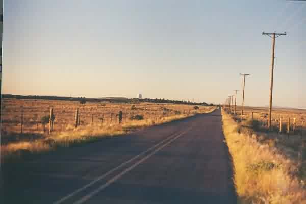
A view of the former AF Station (now FAA facility) and the site
access road as seen from a point just north of I-40 (formerly US 66). The
family-housing area is now called "Lost Horizon." [looking north]
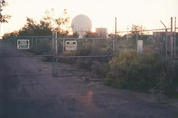
The AN/FPS-91A search radar tower (center) and the Recreation
Building (?) (far right), as viewed from the gate. The road to the left
leads to the former barracks area (fenced off). Time of day was late
afternoon. [looking west]
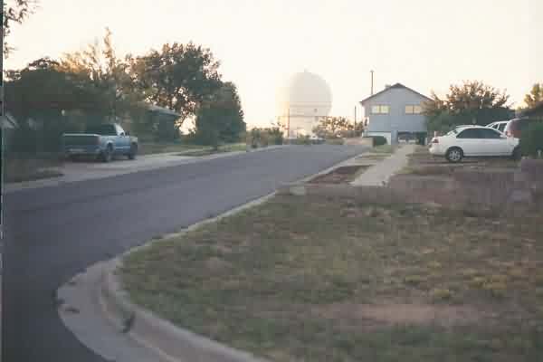
The AN/FPS-91A search radar tower, as viewed from the family-housing
area. [looking north]
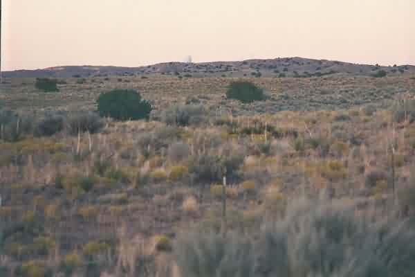
A view of West Mesa and the former AF Station from the southwest.
[looking northwest]
contributed by Kenneth Howard
Additional notes contributed by Marvin Hudson
Ken writes:
It was very disappointing to see how bad the area looks.
There is a 3 way division of the old station. 1) The FAA
owns and runs the Radar Site which is a part of the Enroute
Air Traffic Control System; 2) The housing has been sold to
individuals; and 3) The mess hall, administration, barracks,
and recreational area is owned by an individual, and word is
he wanted to develop it, but ran into much opposition. All
of that is hearsay, but by the looks of the place it must be
correct.
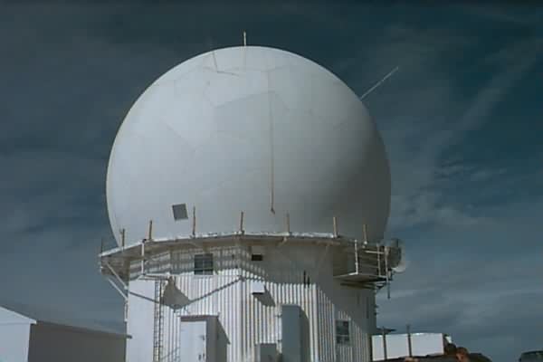
Radar Building which
is the original structure.
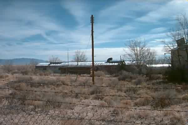
Looking east from the Radar Bldg. at the only
remaining Quonset
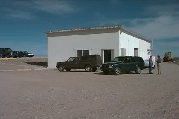
The FAA Admin. Bldg - The building you see in this photo was an addition to the existing Ops building that was built after Ken left. This addition housed some gee-whiz electronic stuff and is where the Radar Maint guys hung out. The original Ops building ended at where this new addition began. The plexliglass tracking board (where the scope-dopes wrote backward using crayons) sat just about where the pick-up truck with the cab is parked. The dias, where the scopes were mounted, was before that, facing the truck.
In August 1966 Mountain States Telephone Company replaced all the manual telephone equipment on the base with automatic switching equipment. The two PBXs in the Comm Center as well as the ten-line units mounted on the scopes were eliminated. This switching equiipment was installed in this new addition to the Ops building and so it makes sense that this building would be retained while all the other buildings were razed.
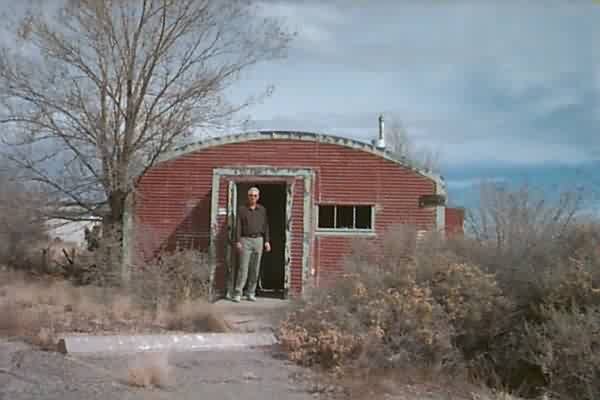
Yours truly standing in the entrance of the
last remaining Quonset Bldg. It was nearest to the Mess
Hall. This is the entrance to the mail room where the post-office boxes were located for the Airmen who lived on the base. This mail room took up maybe ten feet of the building; the rest of the building is the NCO Club.
The entrance to the NCO Club is on the right side of this building. The building to the right of the NCO Club (not in the photo) was the Orderly Room. There used to be a very green grassy area between the Orderly Room and the NCO Club that had a statue of an angry-looking eagle carrying a bomb in its talons. This statue was supposedly "appropriated" from the fighter wing located at Kirtland AFB.
This grassy area was tantilizing to the small herd of cattle that routinely grazed the mesa and these cattle would now-and-then find their way on to the base and graze away on this grass.
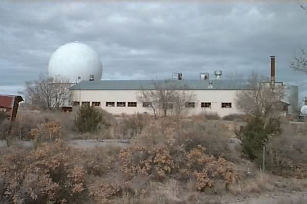
The Mess Hall in foreground with Radar behind
- Looking Northwest
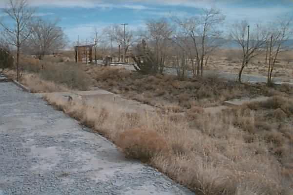
Concrete pads where the 2 easternmost barracks
stood. 4 pad sites remain. This was the South wing of barracks T-15. The next slab over is T-16, a combination of NCO barracks (the North end, by the road), a medical dispensary (the middle section), and a chapel (the Southernmost section) where sometimes early church services were held by a chaplin brought up from Kirtland AFB.
These church services were shown scant appreciation from those NCOs who were trying to sleep off a Saturday night hangover but were awakened by early-morning hymns of "Shall We Gather At The River".
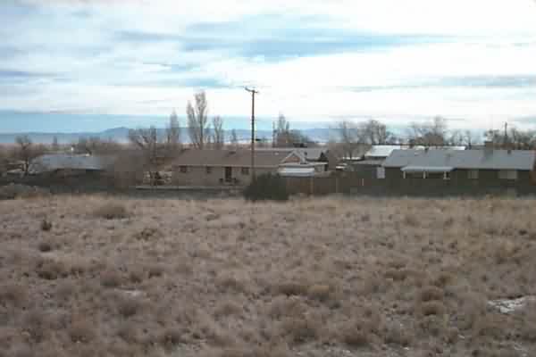
Housing complex looking Southeast from the
barracks area.
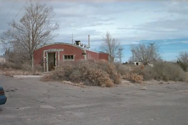
Another view of the remaining Quonset
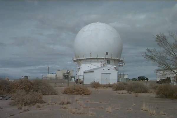
Another view of Dome looking North.
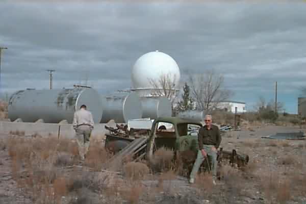
Just for fun - I am sitting on a stripped down
junk pickup left abandoned not far from the mess hall
(barely visible in the right side of photo). The slab to the immediate right of the photographer (not in the picture) is where the motor pool used to be. Ken might have noticed a pit in the concrete slab designed to allow a mechanic access the underside of a car.
The several storage tanks behind Ken and to his right contained fuel oil which was used for heating the barracks, for the water heaters, and so forth. I can`t say ALL of these tanks had fuel oil in them but I know SOME of them did; we used to get fuel oil out of these tanks to fuel-up our "weed burner" - essentially a blowtorch-on-a-stick that we utilized to keep the weeds down.
1969 photos contributed by Dick Schell