Recent Photos of Yuma AFS, AZ
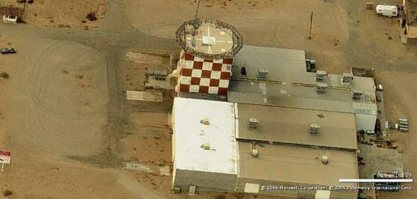
Looking North
.
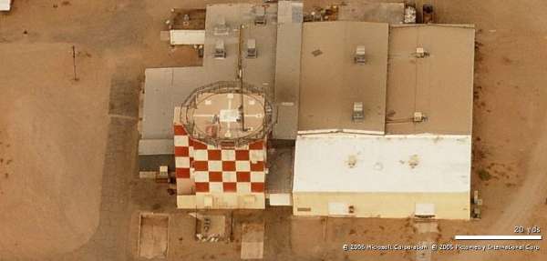
Looking East
.
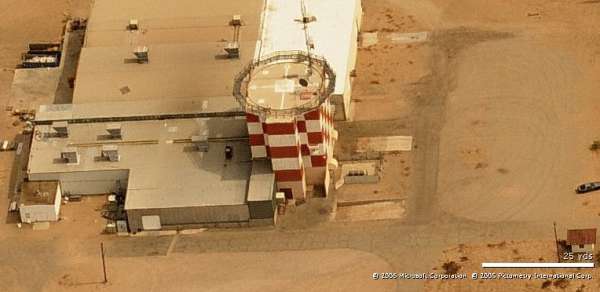
Looking South
.
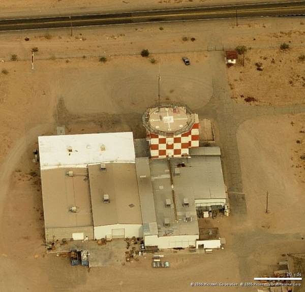
Looking West
.
October 2003 photos & notes contributed by Tom Page

Looking North
.

Looking East
.

Looking South
.

Looking West
.
October 2003 photos & notes contributed by Tom Page
The not-completed Relocated Yuma AFS radar site is located roughly 8 or 9 miles south-southwest of the original radar site at Vincent AFB / Yuma AFS (now Marine Corps Air Station Yuma), and about 13 miles south of the city of Yuma. The first location was a manual AC&W radar operation, and this new site was to have been a SAGE radar operation. At this time, it is not known what model height-finder radars were planned; however, the search radar model is obvious from the tower style. Apparently, construction was halted before any other radar towers were built, so we don`t know if the height-finders would have been two AN/FPS-6 / -90 types, or one of those plus an AN/FPS-26. It also appears that the cantonment area, the family-housing area, and the GATR site were not built, either. [Update: Recently-downloaded 1963 USGS aerial imagery shows four completed radar towers (without radars or radomes): the aforementioned AN/FPS-27 search radar tower, plus two temperate-style AN/FPS-6 / -90 height-finder radar towers and one arctic-style radar tower of the type typically used for AN/FPS-20 variant search radars.]
When I headed south from the main gate at MCAS Yuma (by the way, the main gate is on the east side of the base), I had no clue where to go ... except south. So, I followed that road south as far as it went (paved, that is). Then I had to turn either right or left, and my gut told me right (west). I was pretty much "flying blind," just following the roads and looking around for anything that might look like an old ADC radar station (I`ve seen "one or two" before, so I more or less know what to look for ... except this one was reportedly only partially built ... and that was 40 years ago!). My expectation was, if a radar tower was still standing after all this time, it would be one of those "round" (12-sided) arctic-style towers, probably olive drab in color. So, that`s what I was looking for. After a few miles heading west, after being briefly distracted by a coyote scampering across the road, I spied a structure way up ahead that sort of resembled a Purina grain silo, with the red-and-white checkerboards and all. As I got closer, I started to wonder if that could be my target. I did not think so, as it did not match my expectations. However, when I arrived alongside that site, I could see it indeed was the radar tower I was looking for. I took me another minute to realize exactly what I had just stumbled onto.
This wasn`t a run-of-the-mill AN/FPS-20-series radar tower -- this was much more. This was an AN/FPS-27 radar tower! The AN/FPS-27 was a high-power, frequency-diverse SAGE radar, rather state-of-the-art for its day. This meant that, at the time the new site was being built, ADC was quite serious about keeping this radar station around for a long time. I consider this to be an exciting find! I mean, who knew? This was so unexpected.
I am still wondering what height-finder radar types were planned. Most stations with a frequency-diverse SAGE search radar had an AN/FPS-26 height-finder, also a frequency-diverse SAGE radar (in addition to one AN/FPS-6 / -90 type). However, there were several sites that had either an AN/FPS-24, AN/FPS-27, or AN/FPS-35 FD radar, but no AN/FPS-26. (Also, there were even a number of sites with no frequency-diverse SAGE search radar that still had a AN/FPS-26.) So, the fact that an AN/FPS-27 radar was slated for this site does not offer any clues about the planned height-finders. My guess, though, is that an AN/FPS-26, along with one AN/FPS-6 / -90, was planned, given that all the neighboring radar stations -- Mount Laguna AFS, Ajo AFS, and Las Vegas AFS -- had the AN/FPS-26. But, that`s just my guess. Maybe some day we will locate planning documents for this site, then know for sure. [Update: As mentioned above, the 1963 USGS aerial image show two temperate-style height-finder radar towers, probably for one AN/FPS-6 (-A or -B) and one AN/FPS-90.]
The rest of the trip was good. However, I consider this find the highlight. It was way cool!
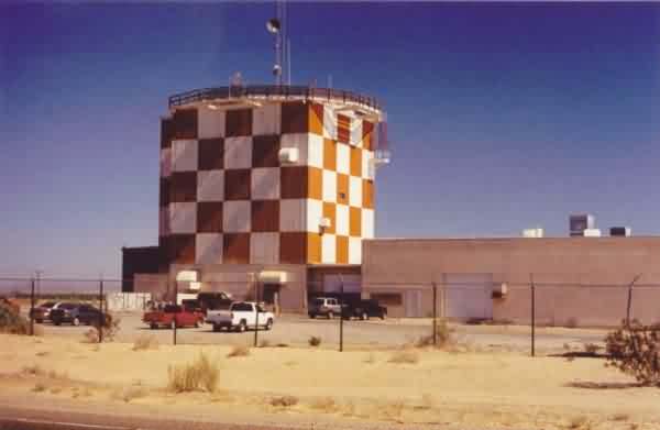
This photo shows the one still-extant radar tower, plus more-modern buildings built since. Note that only the AN/FPS-27 type search radar was housed (originally) in this style tower. Therefore, we now know that an AN/FPS-27 search radar was planned for the Relocated Yuma AFS. The view is from South Avenue B. [looking east-northeast]
.
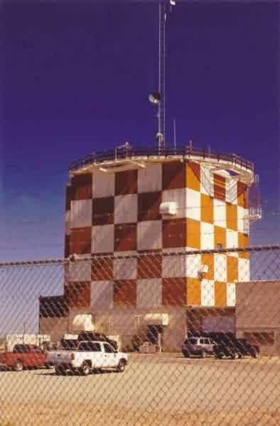
This photo is a close-up of the search radar tower. The red-and-white checkerboard color scheme, no doubt, was to enhance visibility due to the proximity of MCAS Yuma. [looking east-northeast]
.
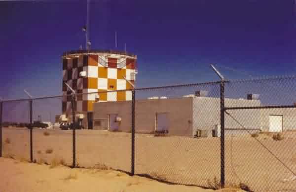
This photo also shows the one radar tower, but from a little further to the south. [looking northeast]
.
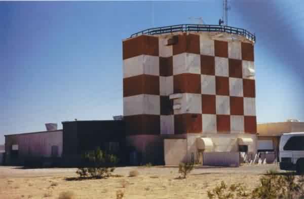
This view shows the northwest corner of the radar tower. The extending feature on its north side was for the elevator, one of the salient characteristics of an AN/FPS-27 radar tower. The concrete base with vents is another tell-tale sign. [looking southeast]
.
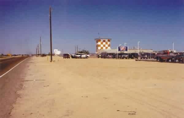
This photo also shows the radar tower, but from still further to the south. A used-car lot sits to the right (east). The north-south road to the left (west) is South Avenue B. [looking just east of due north]
.
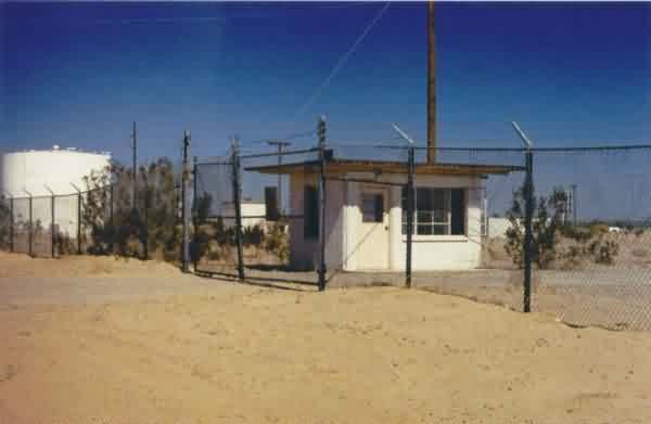
This photo shows the Security Police gate shack at the original site entrance from South Avenue B. In the background to the left is the water tank, water-conditioning equipment building, and pump house -- all USAF facilities built before construction was halted. [looking northeast]
.
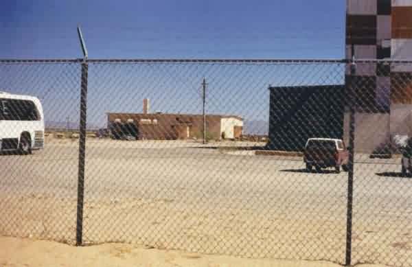
This photo shows the LRR Operations Building, more original Air Force construction. [looking just north of due east]
.
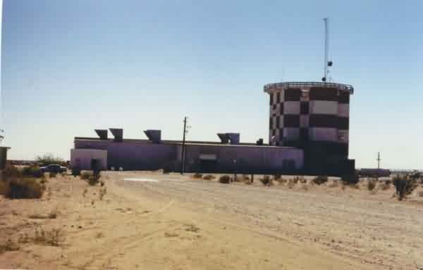
This view shows the north side of the radar tower and a shed built by the new owner. [looking south-southwest]
.
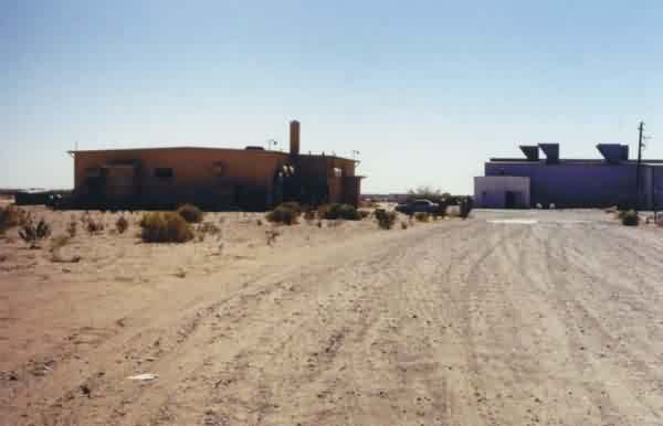
This photo, on the left, shows the LRR Operations Building, original Air Force construction. [looking south]
.
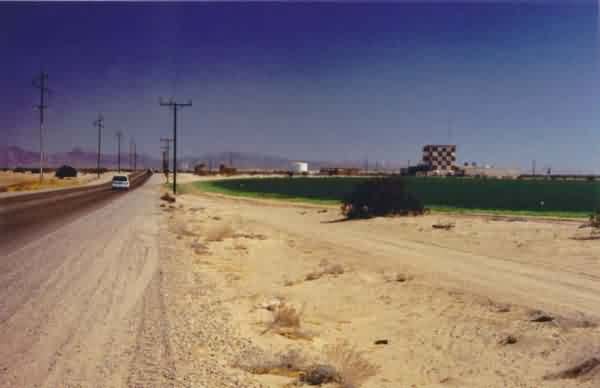
This final view shows the radar site and environs from the west from CO 19th Street. [looking east-southeast]
.