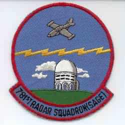
History of Custer AFS, MI
This site began as a "Lashup-Permanent" radar site operating an AN/TPS-1B in 1951. The AN/TPS-1B was installed 17 May 1951, and was declared operational on 30 Nov 1951. The 781st AC&W Squadron began operating AN/FPS-3 (installed on 7 Dec 1951) and AN/CPS-4 radars at this site as of April 1952. An AN/FPS-4 replaced the AN/CPS-4 in 1956, and an AN/FPS-6 superseded this unit two years later. Also in 1958 an AN/FPS-20 replaced the AN/FPS-3 search radar. This radar was upgraded to an AN/FPS-66 in 1961. A second height-finder radar, AN/FPS-6A, was installed in 1959. Also in 1959, Custer AFS joined the SAGE system. An AN/FPS-26A FD height-finder radar was installed in mid 1963. An AN/FPS-28 FD search radar was planned, but was subsequently cancelled. An AN/FPS-27 FD search radar was then planned, but was also cancelled (the tower was not built). The Air Force deactivated the 781st Radar Squadron (SAGE) on 25 June 1965.
References: "Searching the Skies"; misc. ADCOM documents; eyewitness accounts.
Hide