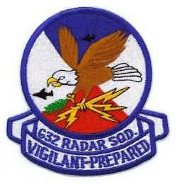
Information for Roanoke Rapids AFS, NC

Latitude: 36-26-25 N, Longitude: 077-43-30 W

Call Sign(s): Bath Box


Perm ID Sage ID JSS ID Unit Location Early
Equip.
Final
Equip.
Oper.
Date
Inact.
Date
Notes
M-117 Z-117   632 Roanoke Rapids AFS, NC MPS-11; TPS-10D; FPS-6; FPS-6A FPS-27; FPS-6A; FPS-26A 1956 01-Jul-78  
M-116A, P-56C, M-117B Z-56C / Z-117B     Elizabeth City, NC FPS-14   Sep-57 Apr-68 * Gap-Filler Annex. Originally was to be M-116A. Alongside Body Road (SR 1139) on its west side, south-southwest of town, on the east side of the original Elizabeth City Municipal Airport. * ADC records list the closing date as on/after ''Dec-67''; one veteran's recollections say ''Apr-68.''
M-116B / M-117D Z-116B / Z-117D     Engelhard, NC FPS-14 FPS-18 Feb-59 Apr-68 Gap-Filler Annex. Reassigned to Roanoke Rapids AFS (Z-117) after Cherry Point AFS (Z-116) closed 1 Aug 1963. Alongside Radar Road (SR 1105), south of town. FPS-18 radar was relocated to the Goldstone Deep Space Comm. Complex for use as a range-safety radar (1976). (This gap-filler radar site was originally planned to be long-range AC&W radar station M-116, built instead at MCAS Cherry Point, NC.)

Current Use: Abandoned. Housing area is occupied.

NOTICE:
Some photos and documents may be marked with varying degrees of classification, up to SECRET. Data so marked is the way it was delivered from official USAF sources, and have been completely declassified. To the best of our knowledge, no currently classified data is stored on this site.
The following site information is available: